The US Army has announced the successful trial of a new visual navigation technology to help military pilots navigate in global positioning system (GPS)-denied environments.
The test, conducted by the Combat Capabilities Development Command Aviation & Missile Center (AvMC), aimed to evaluate if the tech can provide precise location information in the absence of GPS.
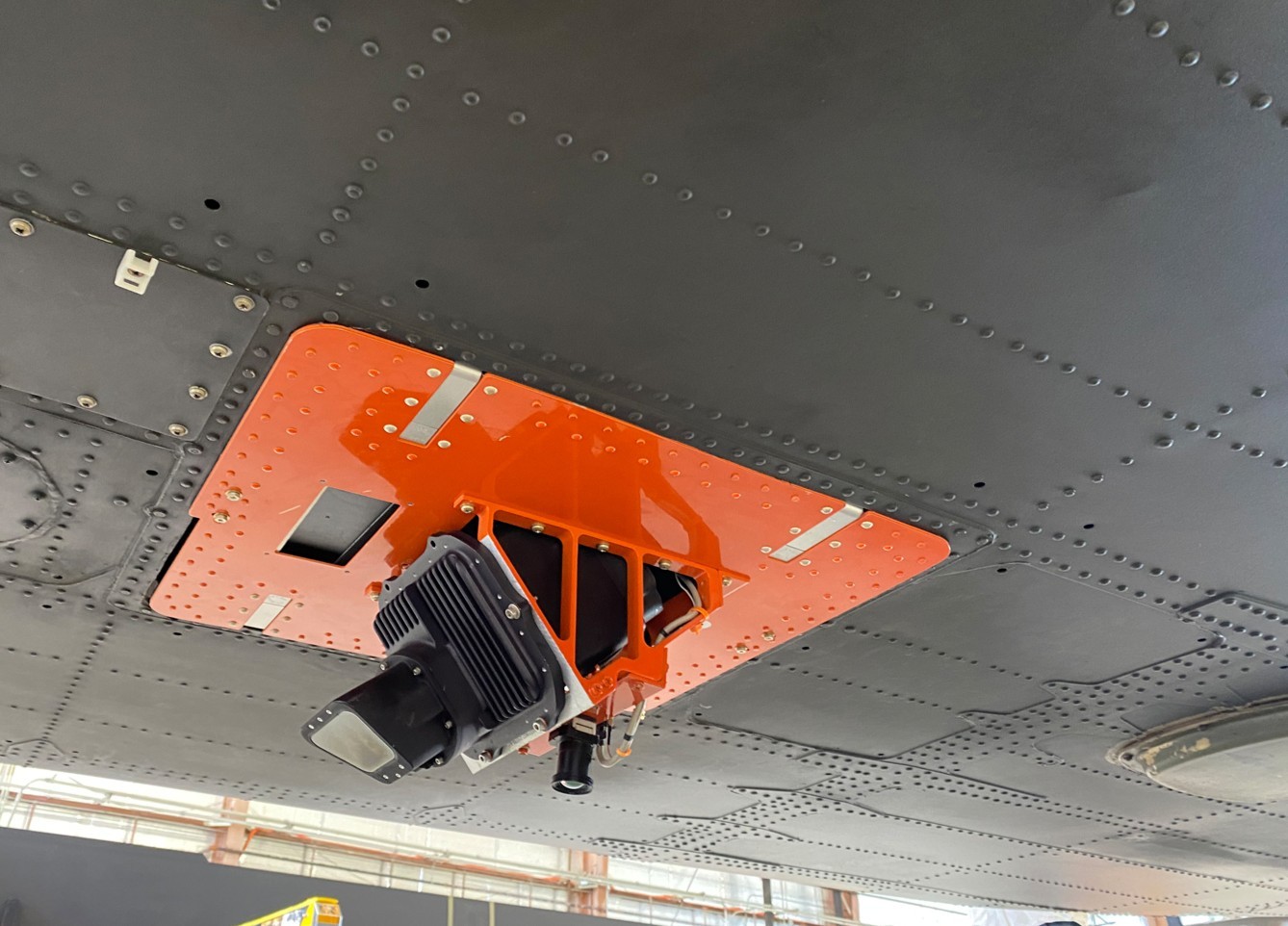
During the activity, a high-performance camera was attached to the base of an experimental Black Hawk helicopter to capture terrain images.
Using the Visual-Based Navigation (VBN) system, the imagery was cross-referenced with a map database, accurately pinpointing the helicopter’s location for its pilot.
“The test … was a success — but the kind of success that wouldn’t have happened without years of work,” AvMC navigation technical area lead Greg Reynolds said.

‘A Win for Modernization’
GPS has been the primary source of positioning, navigation, and timing for many armed forces around the world, making the system increasingly vulnerable to adversaries who invest billions in developing capabilities to disrupt GPS signals.
The VBN is expected to ensure that warfighters will still have access to accurate information in GPS-degraded or denied environments.
Reynolds explained that the recent trial is a win for the US Army’s modernization campaign, especially in the area of assured positioning, navigation, and timing.
The tech could also reportedly help unmanned operations that rely heavily on satellite signals to operate.
“For any autonomous vehicle operation, accurate position information is critical to safe and effective mission accomplishment,” experimental test pilot Lt. Col. Wes Ogden stated.
“If an uninhabited aircraft loses GPS signal, it will need a backup system to provide its position so it can continue the mission and recover safely back to friendly lines.”