
The US Army is seeking an unmanned aerial vehicle (UAV) capable of carrying advanced intelligence, surveillance, and reconnaissance (ISR) payloads at an altitude of more than 60,000 feet (18,000 meters).
The service is challenging the defense industry to help develop a capability for “bridging between an aerial layer and space” through high-altitude platforms, according to Breaking Defense.
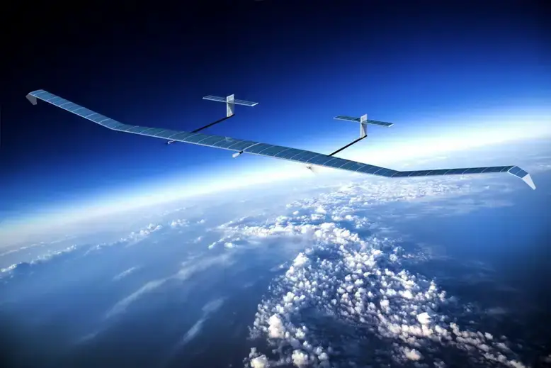
The initiative comes as the army continues to struggle with stratospheric drones that could provide long-term reconnaissance.
Earlier this year, a US Army Airbus solar-powered drone lost contact with the operator following a flight that lasted for 64 days. As a result, the drone’s next test has been delayed until next year.
Mark Kitz, the US Army program executive officer for intelligence, electronic warfare, and sensors, said that the service continues to focus on high-altitude platforms despite setbacks.
He also revealed that the army is interested in building and integrating stratospheric sensing technologies resilient to future environments.
Multi-Layered Sensing Strategy
The US Army’s move to develop high-altitude drones with advanced ISR payloads is part of its “multi-layered sensing strategy.”
“Our strategy has three layers and a foundation: the space layer, optimizing what we can get from government or commercial things on orbit; an aerial layer that includes manned and unmanned platforms from the stratosphere to the mid- to high-altitude layer that is optimized with sensors for a high-end adversary to the ground layer; and the terrestrial layer where we need sensing at echelon,” army deputy chief of staff for intelligence Lt. Gen. Laura Potter explained.
All layers must provide intelligence at high speed so that soldiers are optimized to deliver crucial information to their commanders.
Stratospheric drones with advanced ISR payloads could reportedly support the army’s navigation warfare, assured positioning, and navigation and timing.
They could also allow the service to have “trusted space and trusted sensors in our future.”